
Lewis Heights Village
The apartments at Lewis Heights were constructed during the 1950s under the Wherry program, a congressional act passed after World War II to help with military housing shortages. Demolished in 2003, the housing was replaced by a new development three years later.
Location
When Lewis Heights Village was constructed in the 1950s, it was sited on North Post; the same location as its successor, the existing Lewis Village.
Demolished in 2003, Lewis Heights Village had supplied non-commissioned officers (NCO) with family housing. Located northwest of Woodlawn Plantation, Lewis Heights was on land historically associated with the plantation and the Lewis family.
Lewis Heights Village consisted of 40 buildings grouped along two major streets, Knight and Kimbro Loop. Knight Street extended from Meeres Road and parallel to Woodlawn Road (State Route 618). Kimbro Loop ran in a semicircular pattern from Woodlawn Road and crossed Knight Street twice. The buildings were arranged in pairs which faced one another either across the street or across a common lawn.
New housing was completed in 2006 to replace Lewis Heights Village. The new development, Lewis Village, consists of 274 units.
Architectural Description
Lewis Heights Village was constructed as part of the Wherry program, a congressional act passed after World War II in response to the housing shortages.
In contrast to the standardized plans often used by the military, Wherry-era projects did not require the use of specific designs or construction techniques. Therefore, the finished buildings generally represented the same designs that were constructed for the civilian market during the same time period, resulting in the use of a variety of styles and materials.
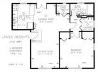
The original 350 units of Lewis Heights Village included 36 one-bedroom, 208 two-bedroom, and 106 three-bedroom apartments. These units consisted of a variety of housing types, including three-story, two-bedroom townhouses; three-story, one-bedroom townhouses; a one-bedroom apartment type; three different two-bedroom apartment types; a three-bedroom apartment type; and, a four-bedroom apartment type.
The buildings featured brick veneer and siding-clad gable ends and had linear or "L"-shaped footprints. Each building contained six to 12 units accessed by three staircases. Several of the buildings had entrances that were distinguished by either gabled or rounded wood porticos supported by Tuscan columns, similar to the detailing used in the 1930s construction of Gerber Village and Belvoir Village.
The apartment-style units included one-story buildings with entrances opening directly into the living spaces. The kitchen was located to one side of the living space; the bedrooms, laundry, and bathroom occupied the other side of the unit.
Five of the townhouse-style buildings were smaller and had triangular or segmented pediments supported by curved brackets or flat brick pilasters over their entrance.
These five buildings were located in the southern end of the development and were linear with rectangular footprints. They consisted of both one- and two-bedroom townhouses. These three-story units included a basement; a first floor, with kitchen, living room, dining room, and half bath; and, a second floor, with bedrooms, laundry, and a bathroom. Sunrooms were added to both ends of the units. Surface parking was provided in front of the buildings or group of buildings.
Fort Belvoir approved the demolition of Lewis Heights Village in 2003. The new housing development, named Lewis Village, consists of 274 Colonial style homes which range in size from 2,218 to 2,785 gross square feet and include a minimum of three bedrooms and two full bathrooms. Additionally, the new development includes a 4,200- square-foot Neighborhood Center with a great room, a meeting room, management and maintenance offices, children's play areas, and village greens. [1]
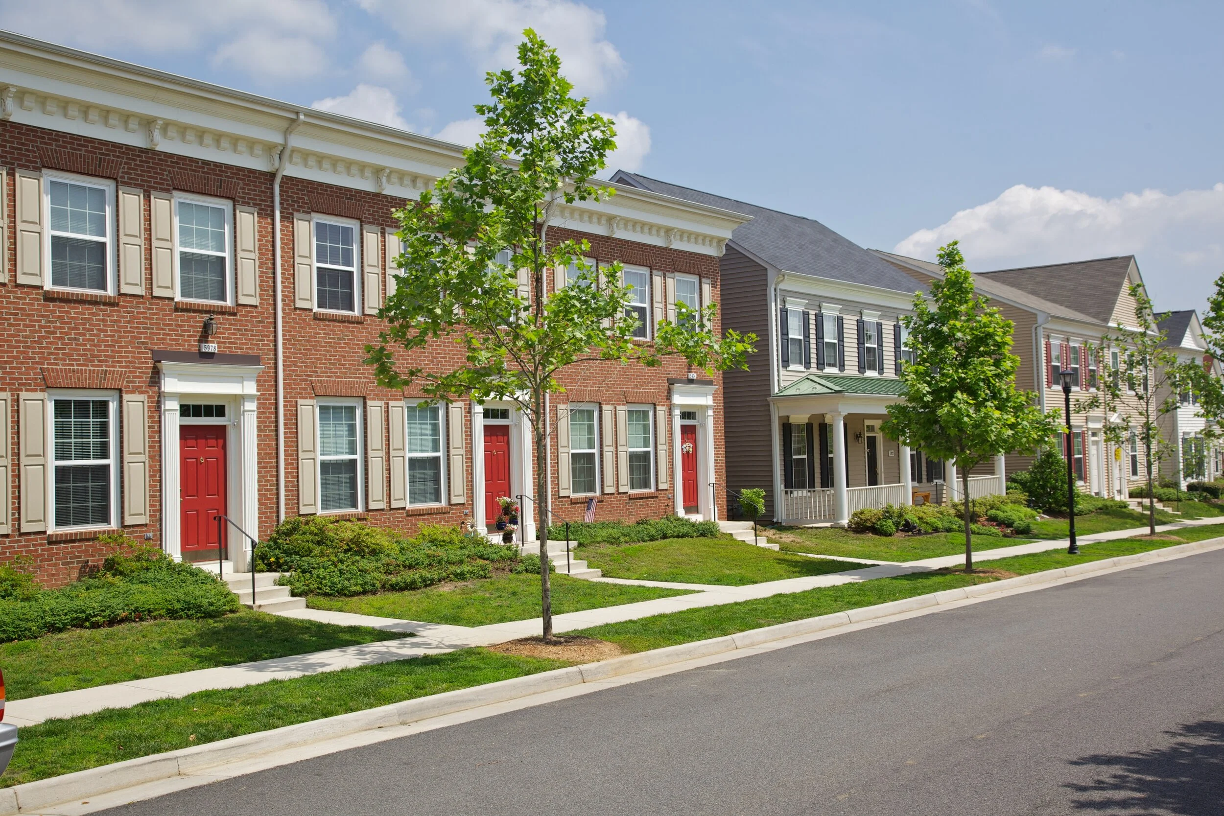
Lewis Heights townhomes.
Statement of Significance
The importance of Lewis Heights Village was associated with two issues. First was the site's strong association with nearby Woodlawn Plantation. Secondly, the original village was important as an embodiment of the military family housing built right after World War II. Lewis Heights Village reflected the need to house returning troops and their families.
Lewis Heights Village was originally planned in the late 1940s on a 30- acre tract abutting Mount Vernon Highway. Supporters of the preservation of Woodlawn Plantation objected to this, however, and the site was relocated to the north side of U.S. Route 1 behind Woodlawn Plantation.
Despite this accommodation, the new village was nevertheless built on land that was formerly part of Woodlawn Plantation, one of the five farms associated with George Washington's Mount Vernon. Records show that a portion of the area, the southern end of the ridge where the Woodlawn mansion is sited, was previously known as Grays Hill. In a 1793 map, Washington refers to the Woodlawn portion of his property as "Chapel Land". [2] Later, visitors to the area would refer to the area as "Mr. Lewis's hill" or "Lewis Hill." [3]
Research associated with the preservation of the plantation indicates that Lewis Heights Village occupied the site of Woodlawn's formal gardens. [4] Over the years and with various changes in ownership, the gardens fell into disrepair.
Lewis Heights Village is an example of Wherry housing constructed at Fort Belvoir. The Wherry Act, Title VIII of the National Housing Act, allowed the Army to lease portions of military land to private developers. In October 1949, the Army announced its intention to lease a portion of Fort Belvoir for the development of 350 privately financed rental units under this new bill. It was estimated that Fort Belvoir was in immediate need of at least 1,600 additional housing units at this time.
By the end of December 1949, 16 prospective builders and developers had submitted proposals for consideration. The project was estimated to cost $3 million to $3.5 million, with construction scheduled to begin by the end of August 1950. A local development entity, incorporated specifically for this project, was selected to build and operate the buildings on land leased from the Army for 75 years.
The average rental price was to be fixed at $83 per month, including all utilities except telephone. Because labor and material markets were still stretched thin after the war, construction did not actually begin until October 1950, with an estimated completion date for the first building scheduled for February 1951. According to the published schedule, approximately one building would be completed per week in order to meet the September 1951 deadline. [5]
After completion of the first group of units, the construction of an additional 100 units was approved. These additional units were scheduled to be located between Youngs Village and Lewis Heights Village, north of the 350 units already under construction. When completed, Lewis Heights Village contained 40 multi-family apartment buildings with 449 units. The houses were intended for Company Grade and Warrant Officers, as well as a smaller number of non-commissioned officers and a few civilians.
There were several problems associated with the Wherry houses. Widespread complaints included their small size and poor construction. Without regulations specifying the size and construction techniques, the Wherry houses developed a negative reputation. In 1955, hoping to rectify some of these problems, Congress passed the Capehart Housing bill. However, installations were required to acquire their Wherry units before the construction of Capehart housing would be approved.
There is evidence that some of these negative issues applied to Lewis Heights Village. In 1959, Fort Belvoir obtained Lewis Heights Village from the housing's private developer. [6] After acquiring the property, Fort Belvoir maintained these buildings, which continued to function as military family housing, until their demolition in 2003.
Memorialization
Lewis Heights Village was named in honor of Lawrence Lewis, nephew of George Washington and husband of Nellie Custis (adopted granddaughter of George Washington). The Lewises resided in the Woodlawn mansion house and managed the plantation.
Fast Facts
Lewis Heights Village
Date of Construction: 1950; Demolished 2003
Housed: Company Grade and Warrant Officers; a small number of non-commissioned officers (NCO) and civilians
Total Units: 449
Unit Type: 40 Multi-Family Apartment Buildings
Architectural Style: Modern
Designer: Lewis Heights Inc., Arlington, Va. (also builder)
Named to Memorialize: Lawrence Lewis (nephew of George Washington)
Lewis Village
Date of Construction: 2006
Housed: E1 through Officers
Total Units: 274
Unit Type: Single Family. Row House
Architectural Style: Modern
Designer: Fort Belvoir Residential Communities, Fort Belvoir, Va.
Named to Memorialize: In memory of Lewis Heights Village
Voices: Lewis Heights Village


[ 1 ] "The Villages at Belvoir," FBRC website. http://www.villagesatbelvoir.com/news-and-events/rebuilding-belvoir-communities/about-the-project/ . Site accessed September 2006.
[ 2 ] Craig Tuminaro. "National Historic Landmark Nomination: Woodlawn." (Washington, DC: National Trust for Historic Preservation, 1988).
[ 3 ] Woodlawn Archives and Library. Written and pictorial documentation including the diary of Mrs. William Thornton. Collection of Woodlawn/Pope-Leighey (Mount Vernon, Va.: National Trust for Historic Preservation, n.d).
[ 4 ] In 1937, Alden Hopkins, a landscape architect, visited Woodlawn" and noted an area . . . to the northwest on an axis with the mansion house in which [Hopkins recalled] daffodils came up in rows forming a garden pattern of walks, giving rectangles, squares and circles on axis with the mansion at the corners were balancing hollies and evidence of brick outcropping of foundations."
William Russell Birch of Baltimore is credited with the design of Woodlawn's historic landscape. Hendrick states "Formal gardens or parterres at Woodlawn had existed in an area now occupied by Fort Belvoir's military housing complex to the northwest of the mansion house."
Karen Smagala Hendrick. "American Society of Landscape Historic Landscapes Survey: National Survey Form and Woodlawn Plantation Survey." (Arlington, Va.: 1990).
[ 5 ] Belvoir Castle. Oct. 1, 1950, pg. 1.
[ 6 ] The property was actually acquired through condemnation after several failed attempts to negotiate a purchase price.
Kathryn M. Kuranda, et al., Housing an Army: The Wherry and Capehart Era Solutions to the Postwar Family Housing Shortage (1949-1962) by R. Christopher Goodwin & Associates, Inc., Frederick, Md.: US Army Environmental Center, 2003, A1.3